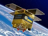
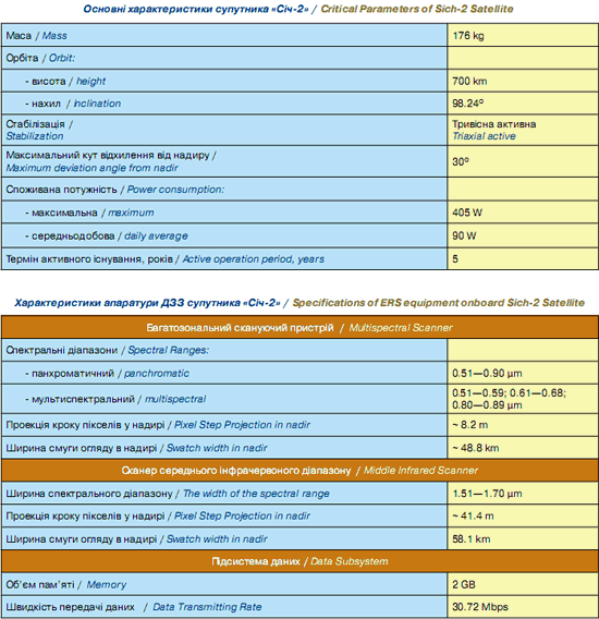
 Sich-2 Satellite is a small spacecraft, designed at the world’s top level in non-hermetic performance with a wide use of polymeric and composite materials.
The satellite is equipped with optical-electronic scanner with three spectral and one panchromatic bands, middle infrared scanner and a complex of scientific instrumentation «Potential».
Sich-2 Satellite is a small spacecraft, designed at the world’s top level in non-hermetic performance with a wide use of polymeric and composite materials.
The satellite is equipped with optical-electronic scanner with three spectral and one panchromatic bands, middle infrared scanner and a complex of scientific instrumentation «Potential».
MAJOR APPLICATION AREAS FOR SICH-2 SPACE SYSTEM
Sich-2 Space System is a powerful tool for obtaining instant data regarding situation on large land areas, sea and ocean, space weather monitoring and retrieval of geophysical effects in the Earth’s ionosphere.
In Ukraine, such data can be used for the benefit of the majority of economy sectors, to provide information for the representatives of public administration, for the purposes of scientific institutions, as well as a wide range of private sector consumers. The national space system Sich-2 can be used in the following major areas:
1. Monitoring of Agricultural Resources.
2. Monitoring of water and land resources.
3. Emergencies Monitoring.
4. Monitoring of the Earth’s ionosphere.